

Trajectory-aware Cross-view Geo-localization with Sequential Observations
Paper • 2607.15491 • Published • 7
🏠 Project Page | 📖 Paper | 💻 GitHub | 📊 SeqGeo-VL Dataset
This repository contains the pre-trained weights for TrajLoc, presented at ECCV 2026.
TrajLoc is a unified framework for cross-view geo-localization that localizes a trajectory instead of a single ground image. Given a street-view video sequence, a natural-language route description, or both, it retrieves the matching geo-tagged satellite tile.
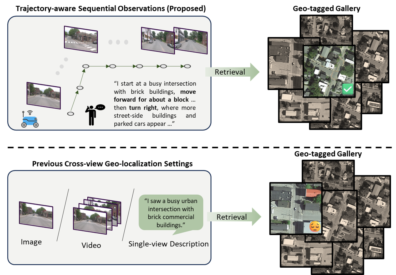
Please refer to the official TrajLoc GitHub repository for installation instructions and dependencies.
You can use the model as a tool for trajectory localization:
from trajloc_tool import TrajLocTool

# Initialize the tool with the pretrained checkpoint
tool = TrajLocTool(
    checkpoint_path="checkpoints/trajloc_full.pth",
    gallery_manifest="gallery.json",       # satellite tiles to search over
    gallery_cache="gallery_features.pt",   # features cached here after the first run
)

# Localize a trajectory using a text-based route description
result = tool.localize_trajectory(
    query_mode="text",
    text="The route heads east along a tree-lined street, then turns right at the church.",
    traj_coords=[[38.6488, -90.3108], [38.6495, -90.3089]],
    traj_headings=[91.0, 92.5],
    top_k=5,
)
print(result)
If you find TrajLoc or the SeqGeo-VL dataset useful in your research, please cite our paper:
@inproceedings{gao2026trajloc,
  title     = {Trajectory-aware Cross-view Geo-localization with Sequential Observations},
  author    = {Gao, Tianyi and Lin, Jiayu and Beaulieu, Danielle and Jacobs, Nathan},
  booktitle = {European Conference on Computer Vision},
  year      = {2026}
}